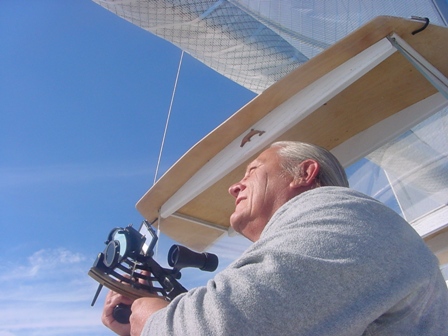
 I was out of the sight of land for a while today so I took the noon sight. You can reduce the numbers down and determine my position at noon if you know the math. I’ tell you this, it was within a mile and half of the GPS position which is pretty good for celestial navigation.
My DR Latitude were 50⁰ N and 60⁰ W
I shot the lower limb of the sun at the following times and altitudes
11h 59m 49s59⁰ 32.8’
12h 00m 4959⁰ 33.7’
12h 01m 40s59⁰ 33.7’
12h 02m 20s59⁰ 33.2’
12h 04m 47s59⁰ 32.9’
I called local apparent noon to be 12h 01m 00s
Meridian passage of the sun was at 12h 06m
The sun’s declination at 1600Z was N20⁰ 09.3’ the d correction was 0.5 for 1 minute = 0.0
The sextant index correction was +1.4’ the dip correction was -1.0’
My course was 090⁰T at 5kts
If you know the math you can find my position at 1201 on 7/22/09
And did you know a total eclipse of the sun occurred today?
Tomorrow I will publish the GPS posit I wrote down

Thanks for inserting the links to Google maps with your locations. How much food do you carry onboard and how do you generally replenish your supplies? Not every harbor/dock area has a grocery store within walking distance…
Tommy! I can’t wait to figure this one out! I am not going to look at your GPS position until I do. I can’t tell you how fantastic it is to see you doing some celestial stuff. I am at sea right now… off Nootka Sound… and made a futile attempt to talk about sextants with some shipmates yesterday. They think I am completely nuts. But I am bound and determined to learn this ancient art… and am thrilled there is somebody else out there who apprecitates it too!