Labrador is no more to be seen over the stern of the CAP’N LEM. I can only glimpse now and again the vague outline of Resolution Island to the west of me. It’s been a slow crossing of the Hudson Strait and that’s just fine by me.
Now the sun is up though hidden in grey stratus clouds and with it the wind picks up to a respectable 10 kts from the south west. The forecast call for south to south west at 15 throughout the day.
Sunday is good to me. I can settle into my at sea routine. Check position, check horizon, and check the lines and sails. Make my coffee, watch the sea go by, make my bed, watch the sea go by, shave and brush my teeth, watch the birds fly by. All the while knowing time is motion, time moves the boat and boat moves me.
I do not know when or where I will pull in next. The settlements on southern Baffin Island are up the fjords and would require backtracking to make any more headway north. I hate backtracking!
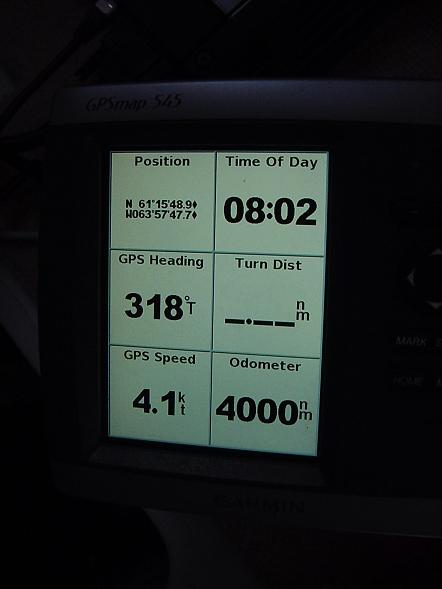
At 0801 local time, (-3) on this day August 1, 2010 in position 61° 15′ 48.9″ N ~ W 063° 57′ 47.7′ W the odometer on the Garman GPSmap 545 turned 4000 nautical miles for Two Harbors Minnesota since April 6th, 2009. I still can’t bring myself to figure the miles left to go. The adventure is open ended and will direct itself. Many factors beyond my prediction and of course beyond my control will come to play in that final figure.
I’m quickly rewarded with …fog. An hour later, it’s gone. I test the seawater temperature. 40.2° F. The air temperature is 49.0° F. I expected it to be lower. I’m learning to only expect the unexpected.

