Beans, Bacon, and Fog

August 9th, 2010

Position Report: 1900 August 9, 2010

58° 38′ 13.7″ N ~ 062° 05′ 01.8´W course. 112° True, speed 3.2 kts. 18 miles of the coast in the Sea of Labrador

I warmed my beans and bacon again tonight. I had been snacking on them cold since I made them yesterday. I made hot tea, too. And I tied the tea bag to the cup handle just the way Captain Lem always did, a half-hitch with the brand tag to hold it in place. I need the warmth of that, too. The fog is back.

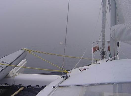
The fog came with the north wind I so want. It’s not the soul chilling fog of Baffin Bay that obscures the water just off the bow, but it is fog nonetheless. But that’s what happens in this part of the world and I deal with it. I call out on the radio to “any vessel in the area of … this is the CAP’N LEM entering fog at…. Please come back with your position, over.” No one has yet responded. No one is here! But there might be and it is the “might be” that makes the fog so arduous. There might be an iceberg. They come marching to the shores of Labrador like an old medieval foot soldier to the shield wall to die each in their turn.

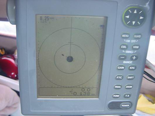
This fog, here out at sea, ebbs and flows like the tides and gives me a break now and again showing me what’s out there, nothing, confirming what my wonderful little Furuno Model 1622 Marine Radar, which was not work in Baffin Bay and now so wonderfully is working, shows me, nothing. Nothing out there is a very good thing, in the fog off the coast of Labrador.

I thought of running for Hebron but then I’d be back in with the rocks and shoals and the huge Atlantic swell that I battled yesterday to get out here. Hebron will be one of those places I guess I’ll never get to visit. To bad, Hebron has a history. Instead I’m aiming for a point 60 miles away that will take me far off the Mugford and her Tickle.

I have three more hours of daylight to help and then the fog and the dark. Ah, but now I have my blessed sea room. Sea Room! It gives me comfort like a pillow.

Northern Lights

August 9th, 2010

0600 Position Report August 9, 2010

Underway at sea c124° T s-2.5 wind NE 8 kts 59° 04′ 03.7″ N ~ 062° 49′ 36.9″ W

Up anchor from Sea Plane Cove when wind came steady from NW to proceed out to sea and catch today’s predicted NE wind. Outside of Big Bear Skin Island, encountered large long Atlantic swell rolling in from the SW, right where I want to go. Slugged through them at 1.5 to 2 kts and as the water depth increased the period of the waves got longer and I made slow progress in the right direction. The wind shifted to S five miles off shore but I was able to make an easterly heading on out clear of shoals and icebergs. After sunset the wind shifted again to a light NE and I spent the night make slow but good progress.

The Northern Lights played across the sky after dark. There was one bright planet in the east which made for a beautiful night at sea.

This morning the wind is light but steady from the NE. The swell remains large so there is a lot of rocking and rolling as they lift the CAP’N LEM high then roll out from under. I try different down wind tacks but progress remains slow and steady to the south. I hope to make it to Hebron today and check on buying some fuel for margin sake. If the wind comes up to the 20 kts as forecast, I’ll continue on. I still have 5 gal spare and 2 or 3 in the tank. I’m hoping to meet with the S/V Issuma as she makes her way north for Greenland. It’s always great to meet like minded people out living their dreams.

Sea Plane Cove

Sea Plane Cove

Sea Plane Cove

August 7th, 2010

1800 August 7, 2010 Position Report

The CAP’N LEM is still anchored in Sea Plane Cove, same as before. I’ve set the “wait and see” watch. The weather forecast calls for a change in wind to the NE on Monday. I need to conserve fuel to thread the islands and channels getting into Nain. I do have to run the engine to make electricity because there hasn’t been enough wind to turn the Aerogen to keep up with my needs. I monitor the voltage pretty close so not to run both batteries down.

It’s rained most of the day and I’ve stayed down below by the fire reading, napping, and going through bins. A dull dreary day, but nice not to be traveling in the fog. I keep getting up so early. This morning it was 0450. No use fighting it. When I wake up, I get up.

Today I watched a polar bear make his way around the cove turning over rocks, sniffing and generally doing bear things. I’m above the tree line so there are no trees or bushes for him to hide behind. I couldn’t tell if he actually ate anything watching him with the binoculars but he never seem to give a look out my way. I understand they can smell a long way and I’m anchored right up wind of him but he wasn’t interested me and eventually wondered off, yep, over the mountain. Guess that’s what bears do. They sure are majestic to watch.

Big White Bearskin Island

August 6th, 2010

1700 August 6, 2010 Position Report:

59° 22′ 14″ N ~ 063° 47′ 00″ W At anchor in 41′ of water in Sea Plane Cove near Big White Bearskin Island, Labrador. It’s very calm and very quiet. I’m sure beautiful too if I could see it but for the fog!

I awoke at 0430 due to having gone to sleep at 2000 (8 pm) to just a hint of twilight. The nights are lengthening now both from the date and the latitude toward the south. Fog. But in the fog was the hint the morning north wind so I quickly did my chores and prepared to get underway. Engine cooling, check. Radar working, check. Let’s go.

Up the anchor and slowly retraced my track line out of Eclipse Harbor for open water. Air temp 44° F. I didn’t take the seawater temp. The fog tells me, 100% humidity. It’s going to be a long day. At the mouth of the harbor I raise sail and catch a bit of north wind and turn south.

The radar, the GPS, the large scale charts showing small areas on the plotter give me the confidence to go. By noon, no change, still foggy. The wind comes and goes so mostly I motor at a slow 4 kts to conserve fuel. I never push the ‘little engine that could’ hard anyway. The wind will change and I’ll make up the time. But still, I can not give up the opportunity to go south with this light breeze from the north.

I’m reminded of one August sailing trip out the Strait of Juan de Fuca between Washington State and Vancouver Island with my brother-in-law and two young nephews. We were headed for West Port Washington around Cape Flattery but the wind and swells made two of the three so seasick we aborted the trip and turned around…into the fog. My boat, my idea, my trip…my responsibility.

Oh, ye landsman, what do you ever do that gives such weight to the shoulders as a trick at the wheel, in the fog, in the wind, in the night. There is no more precious cargo than young ones sleeping in trust below while you make way for port. Nine hours of looking, listening, doubting, confirming, checking, correcting, and repeating. To be captain of anything, sail boat, ocean liner, battle ship or airplane is to know the terrible weight of responsibility that can not, must not slip from one’s shoulders for a moment. One of my favorite captains that I served under took a nap every afternoon underway while the rest of the ship worked. Why? As he said, because he never knew when he would be needed to be up all night long.

So think long and hard before you set you sights on that lofty title “Captain” as I once did in my youth. It comes with a price.

Eclipse Harbor

August 5th, 2010

Position Report 1030 August 5, 2010 59° 47′ 44″ N ~ 064° 08′ 47″ W Eclipse Harbor, North Aulatsivik Island, Labrador Anchored awaiting changes in the weather.

Another red sky morning but I still wanted to move some with a slight land breeze coming from the northwest. Getting ready to get underway. Trouble! The little Honda is having a urinary problem. Now this is scary. She’s running fine but no pee. Overheating problems with the engine are a “Show Stopper”! There is no changing of an impeller short of going to the shop according to the manual. I check the intakes. Clean. Only one thing to do. Try a catheter. I search to boat and find the remnant of the stainless steel wire Jon Birdwell used when building the splendid gantry to hold the radar and wind generator to give it rigidity.

I climbed to the stern weaving my body through the gantry locking one leg around to free both hands and felt for the little port through which the cooling system squirts just enough water to show that it is working. At first it’s hard to find where to insert the wire. It can’t be seen from this angle. Then the question is the wire small enough. Yes, just barely. It stops, starts and stops again but by now I have it at least 3 inches into the outlet so pull it back out. I look closely at it and think or imagine I see some scum. But it’s too early to tell and I don’t want false hope.

Carefully disengaging myself from the gantry making sure I don’t step on and break the Autopilot, like I’ve done before, I climb back into the cockpit. Turn the key and start the engine.

The operation is a complete success. The patient has recovered. One more crises averted and I go haul the anchor. Very little is very easy on a boat.

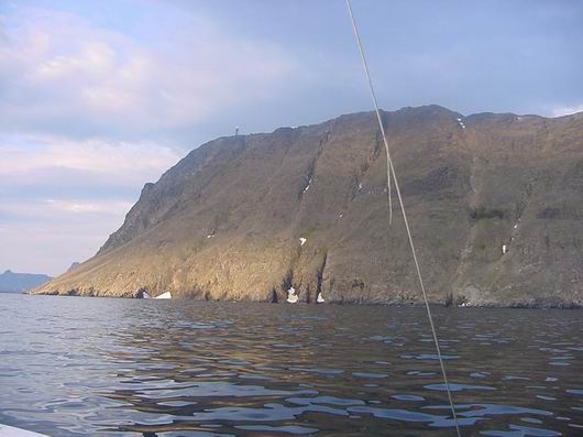
Radar dome on top of mountain Caption Whiteman's Inukskuk

Radar dome on top of mountain Caption Whiteman's Inukskuk

I motor out of the harbor and turn south past the Whiteman’s Inukshuk perched high on the hill and catch a south flowing current and just enough wind to move along a slow 4 knots.

By 1030 I’ve come to the end of Eclipse Harbor. I had hoped I could make it all the way around the west side of North Aulatsivik Island but no, an isthmus blocks the way and even at high tide there will not be enough water to cross it. Never mind, it’s a beautiful and safe anchorage to wait out any storm. And I’ve planned something special. A bath in a bucket!

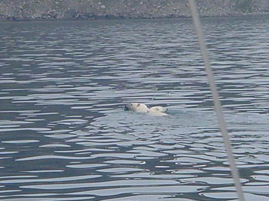
On the way in I come across a mother white bear and her cub swimming for the far side of the fjord. I only come close enough for a picture then turn quickly away to give them peace. Yes, there are bears here, but I don’t believe they will come onboard the CAP’N LEM. I’m ready though, with my air horn and signal flares, just in case.

eclipse-harbor-and-bears-011resized

1800 August 4, 2010

August 4th, 2010

Position report: 60° 01′ 50″N ~ 064°11’43″W anchored, Air temp 47°F Seawater (in the bay) Temp 45.7°

I left Bowdoin Harbor with working radar. The antenna drive belt had come lose again. I’m resolved to using it sparingly. It might have something to do with running while the boat is pitching in the swell. If, or more like it, when it comes off again I’ll fabricate a shim to hold the spindle higher. Let’s hope I don’t have to attempt that at sea.

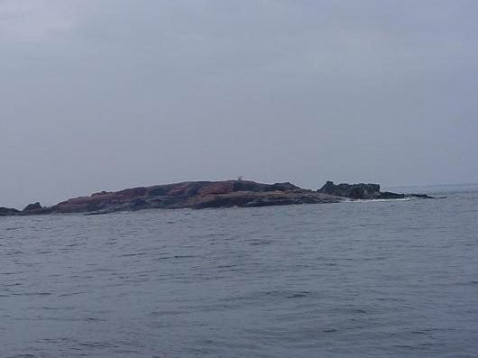
The working radar is all the difference in the world in the fog. Yes, the fog closed in again as I made my way slowly south. The pictures first show the radar then what came out of the fog. When it works it works well. Considering the age is it any wonder the belt might be a little stretched.

bowdoin-harbor-to-shoal-harbor-036resized

I encountered another bear sitting on a rock island just outside the harbor as I made my way to sea. The boat didn’t bother her coming toward the island. I say her because of size compared to the big guy last night. When I made smacking noises, though, she took offense and scampered out of sight. I don’t know where she went because she was no where to be seen on the other side of the island.

bowdoin-harbor-to-shoal-harbor-030resized

Tonight’s anchorage is in Shoal Bay near Williams Harbour where I found such good anchorage. This seems good, too. I backed down hard on the anchor rode and it held. There is some ice in here, left over bergy bits from the big grounded bergs out along the coast. If they come to the boat then I’m convinced they are magnetic. It’s a lovely lonely place with caribou roaming on the beach. I don’t know what they do on the beach but this is twice I’ve seen them their.

I am looking forward to a peaceful night and day tomorrow as I wait a change in the winds. Forecast calls for 25 Southeast, right where I want to go. By waiting a change I can cover much more ground with lot less ware and tare on the boat and me.

My next stop I hope to Hebron. It all depends on the wind. Maybe I can transit the Mugford Tickle again!

2100 Position Report

August 3rd, 2010

At anchor on Killing Island, Labrador 60 20′ 24.4″N ~ 064 28′ 35.7″W

Bear Country. Biggest dang polar bear I’ve ever seen and it was right in the way of coming into my harbor.  Or maybe it’s his harbor, but I’m not moving out into that fog for him or anybody.  I spent 6 straight hours staring at white to get here, he’ll just have to share tonight.  Tonight I’m sleeping straight through unless I have to wrestle a bear off the boat.

After I took a couple of pictures he climbed out on the island guarding the harbor. Sorry the picture is so bad but its the fog! He was so magnificent all I can say he truly is the king of this land. He doesn’t look so big in the water but its just my snapshot photography.

polar-bear-009resizedpolar-bear-010resizedpolar-bear-012resizedpolar-bear-013adjusted-and-resized

August 2, continued

August 3rd, 2010

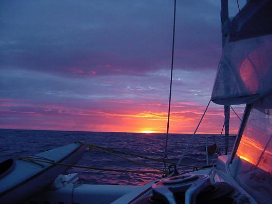
“Red sky in the morning, sailor take warning” must surely have been penned by someone who looked on the same redness in the rising sun as I saw this morning. I can only imagine what must have followed that red sky for him but I am intimately acquainted with what followed my RED SKY IN THE MORNING.
sunrize-baffin-island-031resized

Fog eating iceberg

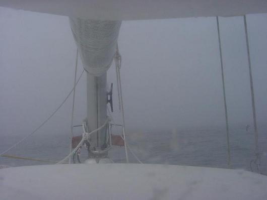
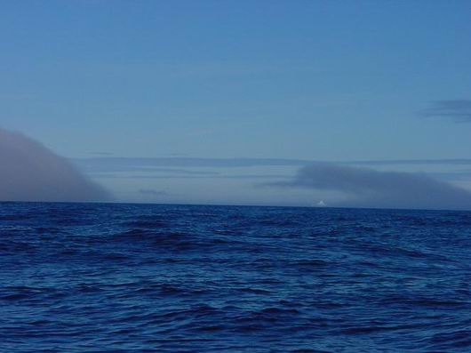
The fog ate the icebergs around me one by one before seizing hold of the whole world as I knew it. The wind veers to the northwest and seems to spew the fog from a nozzle. The red of the morning is gone. The horizon is gone. Even the line between air and water fails to be discernable. This is no tall tell and I’ll not say “couldn’t see the bow”. The CAP’N LEM is only 31′ long. I could see the bow and perhaps one more boat length into the gray white mist over gray blue water. As the cream dissolves into the coffee so the fog dissolved into the water.

My little radar flashes its warning HD-SIG-MISS on the screen and is useless. I leave it on anyway. I become obsessive with staring into the fog only allowing a glance at the plotter now and them. I break away long enough to take in the headsail to slow my progress even farther. Then back to the stare. It takes me 35 minutes to open and warm a can of chili for breakfast. (Get the can, go back and stare, get the can opener, go back and stare, get pan, go back and …) My minds eye sees over and over the 200′ wall of ice from last night’s nightmare.
sunrize-baffin-island-027resized

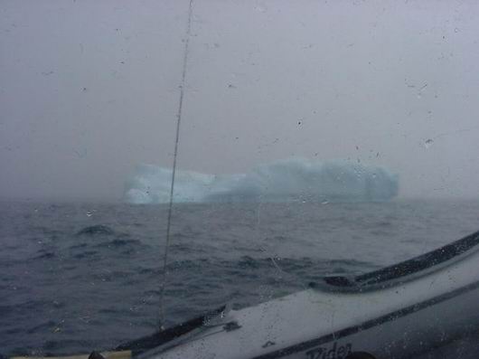
berg in fog

How long do I stare in to the nothingness before I see something move in the water off to port? 20 minutes, 40? A bergy bit wallowing in the swell. For a moment I’m relieved to know just how far I can see. Perhaps 50 yards, more or less. It passes on into the fog and once again I lose all perspective, but there are more. My speed over the ground, 1.6 kts, mostly from the little engine at idle ahead, ready to help if I need to turn quickly. It would help me stop to if I slam it into reverse. Still I only creep. The wind is in the fog and I pick up speed with the mainsail along and I don’t like it but I just keep staring into the white of it all. 2.5, 3.2, way too fast for comfort.

Vision is based on contrast, here there is no contrast beyond the lines of the vessel and a few wavelets on the water close aboard. I jump at shadows. A cold tingle races up my spine. You know the kind, like someone just told you a ghost story that you believe. The fog is thick horizontally but thin vertically. There are clouds overhead and a cold hazy sun moves in and out. The shadow I see this time is the sail on the silver screen of the fog.

The next shadow is a berg, big but not especially so. I’m relieved to see it. At least I know where this one is and it’s off the port. I steer around and look for the next one. By noon, I’ve encountered 5 bergs in this manner. By noon my nerves are shot. By 1300 the fog lifts long enough to show me a clear path…south. Quickly, I e-mail Ken. I’m done, I tell him. I admit to Ken, myself, God and the whole world. I’m done, I can’t do this. Then, the fog closes in for more. My one mile trip has now become my 100 yard trip. My thoughts are, just make the next 100 yards toward the clear pathway you were shown. That’s all that is important now. The next 100 feet.

The fog doesn’t lift for another 3 hours and I see the sea ice, bergy bits and ice bergs I’ve navigated through. And that was just the beginning!

I’ve come to the doorway of the Northwest Passage and not even made it up the steps. Doesn’t matter, it has given me my White Dawn adventure, and I’m sick of it! Let the Sons of Norway* made their historic voyage. It’s fitting. Let them prove the Corsair -31 a proper vessel for the Northwest Passage. I have nothing to prove. Not to myself or to anyone. After hours of staring into the unknown I see the fate of Franklin, the misery of Amundsen, the disappointment of those who tried and failed and those that tried and died. I’ve seen enough ice to last a lifetime.

It was a beautiful dream to sail the Northwest Passage and now it is a beautiful reality to turn my back on it and head toward other adventures. If we’ve learned anything at all, it is this: The journey and not the destination is the adventure. The destination was just a wonderful excuse. Let’s go to Labrador and look for white bear!
sunrize-baffin-island-022resized

Position Report August 2, 2010

August 2nd, 2010

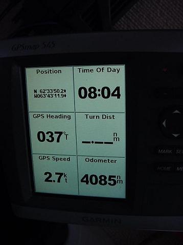
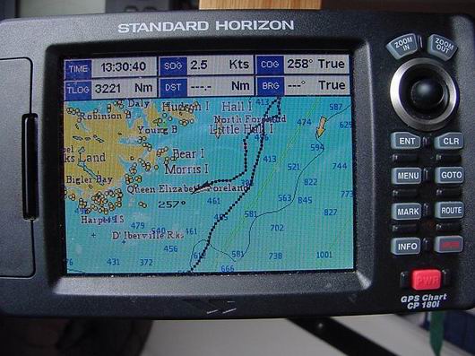
Position at 0804 August 2, 2010. 62° 33′ 50.2″ N ~ 063° 43′ 119″ W course 037° speed 2.7 kts. Having traveled 85 nautical miles in 24 hours. Sea water temp. 35° F Air temp. 38° F

sunrize-baffin-island-007resized

I missed a wakeup. When I came to and realized how long it had been since I had scanned the horizon I leapt up. The first thing I saw was bergy bits everywhere, big ones. The second thing I saw was it. It was a cliff of ice 200 feet tall not ½ mile away. That will haunt my nightmares for years to come. Each berg is under cut by the sea much the way the tree that fell on my motor home was. If I hit one square on no doubt it would calve. End of story. (I didn’t take its picture. A don’t need it. I see it every time I close my eyes.)

Red sky in the morning, sailor take warning!

Red sky in the morning, sailor take warning!

Then the sun rose the likes I have never seen in its redness and eeriness. Morning chores. No sleeping now, though I can hardly hold my eyes open, I remember and photo the 0800 position. By 0810 the fog hits.

sunrize-baffin-island-017resized

To be continued.

August 1, 2010 Position Report

August 1st, 2010

Labrador is no more to be seen over the stern of the CAP’N LEM. I can only glimpse now and again the vague outline of Resolution Island to the west of me. It’s been a slow crossing of the Hudson Strait and that’s just fine by me.

Now the sun is up though hidden in grey stratus clouds and with it the wind picks up to a respectable 10 kts from the south west. The forecast call for south to south west at 15 throughout the day.

Sunday is good to me. I can settle into my at sea routine. Check position, check horizon, and check the lines and sails. Make my coffee, watch the sea go by, make my bed, watch the sea go by, shave and brush my teeth, watch the birds fly by. All the while knowing time is motion, time moves the boat and boat moves me.

I do not know when or where I will pull in next. The settlements on southern Baffin Island are up the fjords and would require backtracking to make any more headway north. I hate backtracking!

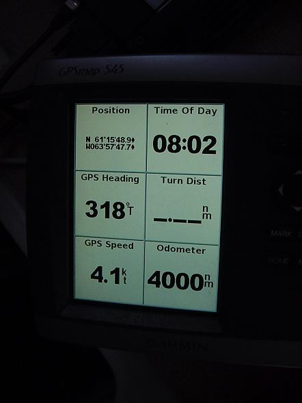
At 0801 local time, (-3) on this day August 1, 2010 in position 61° 15′ 48.9″ N ~ W 063° 57′ 47.7′ W the odometer on the Garman GPSmap 545 turned 4000 nautical miles for Two Harbors Minnesota since April 6th, 2009. I still can’t bring myself to figure the miles left to go. The adventure is open ended and will direct itself. Many factors beyond my prediction and of course beyond my control will come to play in that final figure.

I’m quickly rewarded with …fog. An hour later, it’s gone. I test the seawater temperature. 40.2° F. The air temperature is 49.0° F. I expected it to be lower. I’m learning to only expect the unexpected.

4000-miles-002resized